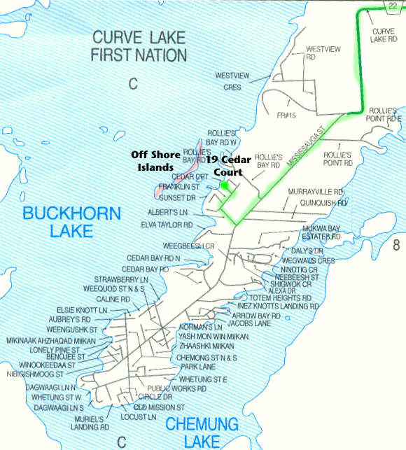
You're almost there. The route is marked in green on this map. Verbal directions follow in point form.
- You are on Curve Lake Road (highway 22).
- It becomes Mississauga Road at the beginning of the Curve Lake First Nation.
- There are two large gas stations on your right as you enter Curve Lake First Nation.
- Continue past Rolly's Bay Road on the right (first right on Curve Lake territory).
- Turn right on Albert's Lane - approx 2.4 km, or 1.5 m, in Curve Lake First Nation. [If you see Garfields on the left, you have gone too far.]
- Continue a short distance to Franklin Street.
- Turn right and continue to second left at Cedar Court.
- Our cottage is at the first right bend in the road. (Green 19, plus our name.)
NOTE: This map does print reasonably, even in black and white. The route is simple enough that I have not added any comment to the actual map.